
Structural Geology (non-technical)
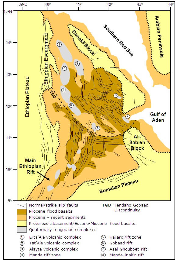
Figure 1: Geological map of the Afar region showing fault orientation and distribution of the magmatic segments. After Barberi & Varet, 1977; Hayward & Ebinger, 1996; Hofstetter & Beyth, 2003 and Rowland et al, 2007.
Structural Geology of the Afar Region
The movements of the Nubian, Arabian and Somalian plates over the past 30 million years or so have created a series of different landscapes across the Afar region each with their own distinct style Figure 1. These are:
Ethiopian and Somalian plateaux
Southern Red Sea and Gulf of Aden
Explanation of geological terms used in the following pages:
Fault – a break or fracture in the rock which allows the rocks on one side to move relative to the other.
Rift – a region of low-lying ground (often below sea level) formed as the Earth’s crust is pulled apart as the plates move away from each other. As the crust continues to be pulled apart volcanism along the centre of the rift creates new crust to fill the gap. The Afar Depression is just reaching this stage. Where fully developed a new ocean is formed (e.g. the Red Sea) with new crust being erupted along a mid-ocean ridge.
Basin/graben – a low-lying area between faults created as the faults have moved.
Horst – an area of high ground between faults created as the faults have moved.
Fault block– an area between faults that has been tilted as the faults have moved.