
How geodesy works
Watching the Earth move with geodesy
Magma collecting beneath a volcano or the slow movement of tectonic plates that cause earthquakes produce changes in the height of the Earth’s surface.
Space geodesists use satellite observations to very accurately measure these changes. The measurements are carried out using InSAR or Interferometric Synthetic Aperture Radar. The satellite orbits the Earth recording images of and measuring precisely the distance between itself and the ground. The same area is imaged about ten times a year.
These images are then combined to make maps of the variations in the height of the ground surface, called interferograms. Each different colour band on an interferogram represents a 3cm change in the distance between the satellite and the ground.
The interferograms allow scientists to determine where, how and by how much the ground is moving.
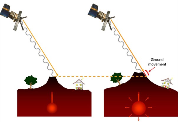
Satellites measure the distance to the ground several times a year.
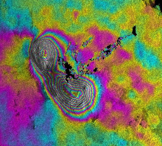
An interferogram - the different colour bands represent 3cm changes in the distance between the satellite and the ground.