
Fieldwork Campaigns
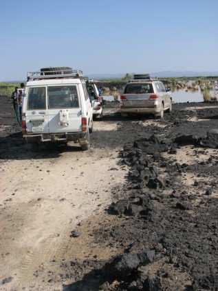
Flooded road on the way to Badi volcano. Photograph by Nick Johnson, University of Edunburgh.
Fieldwork Campaigns
February 2010 field campaign
BGS team
The BGS mapping team conducted two periods of fieldwork in February and March. The first campaign was conducted alongside the Seismic team and involved the collection of samples all over Afar, from the western rift margins to Semara and northward to Erta Ale. The purpose of these samples is to groundtruth the composition of units seen in remote sensing imagery and use the interpretation of these sites to extrapolate geological linework into areas that we cannot reach. On the second period of work BGS joined a team from CNRS-Nancy, France into the centre of the northern rift segment on the southern flanks of Dabbahu volcano. Detailed fieldwork was conducted on the nature of basaltic lava flows, stratigraphy and the relationship between Dabbahu and rift axis fissural volcanism. Further samples were also collected here to identify any petrologic relationship between the two styles and periods of volcanism in this area.
MT team
During the recent field campaign the MT team collected data from two distinct regions of the rift. First, six new sites were deployed between Digdiga and Barantu: a 30 km long profile trending northwards parallel to the active rift and passing as close as possible to Badi and Dabbahu volcanoes. The data look to be of high quality, and we hope that they will allow us to image magma reservoirs which directly supply the volcanoes and on going dyking events.
The second area visited was 20-30 km north of Semara, the regional capital, where an intriguing area of subsidence had been detected by satellite observations. Some of this area, called Saha, was flooded due to heavy rain several weeks prior to our arrival, but with careful navigation using our satellite image we managed to get to within a few kilometres of our desired locations. Four sites were occupied between here and our 2009 profile, and again we hope to detect something (magma?) which may explain the subsidence seen in the InSAR.
Both new sets of data will be used to build up 3D models which will be based around the 2008 and 2009 MT profiles which cross the rift.
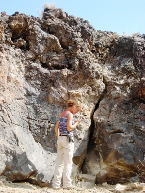
Charlotte Vye (BGS) studying the Afar Stratoid Series in the Dobi Graben during the January 2008 field campaign. Photo by Lorraine Field, University of Bristol.
February 2009 fieldwork campaign
During the February fieldwork Nick Johnson a PhD student from the University of Edinburgh kept a blog of his experience.
Nick's blog (word doc)
October 2008 fieldwork campaign
For the October field work in Afar James Hammond kept a blog for NERCs Planet Earth website. In it he details not only the work he and the team were doing but also visits to local churches, schools and archaeological sites. Follow the link below...
http://planetearth.nerc.ac.uk/blogs/all.aspx?id=276
January 2008 fieldwork campaign
Many members of the Consortium where out in Afar this January. Lorraine, Dave and Talfan (PhD students) kept blogs and Tim Wright (Principal Investigator) sent back regular reports.
Lorraine's fieldwork blog (pdf file)
Dave and Talfan's fieldwork blog (pdf file)