
BGS in Afar
Sample collecting rift basalts with Dabbahu volcano in the background. Photograph by Lorraine Field
British Geological Survey - Mapping the Afar Rift
BGS are currently involved as project partners alongside the NERC Afar Rift Consortium. The BGS role in this research is to conduct geological mapping of the Afar region, encompassing all the active research areas, to provide an overview of the stratigraphy and the changes in style, location and composition of volcanism with time. The project utilises interpretations of remote sensing data to support ground-based fieldwork. BGS brings complementary expertise to this research consortium to tackle some novel research in this unique natural laboratory.
b.jpg)
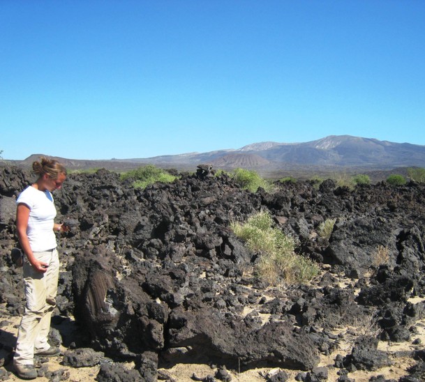
Surveying an inflated lava lobe. Photograph by Lorraine Field.
Airborne and satellite remote sensing techniques allow rapid mapping in terrain that is inaccessible to conventional fieldwork. Remote sensing measures spectral reflectance and emittance from the Earth's surface using sensors mounted on airborne or spaceborne platforms. These measurements are used to infer the nature and characteristics of the land at the time of observation by comparing the image spectral response patterns with reference spectra of known surface materials. In order to compare like with like, atmospheric effects must first be removed from the data with subsequent conversion to units of reflectance, as measured for the reference materials.
Geological materials have characteristic absorption features at particular wavelengths and as long as there is sufficient spectral detail then image analyses can be performed to provide an interpretation of the exposed geological materials. Landsat ETM+ data has been acquired and processed for the AFAR region.
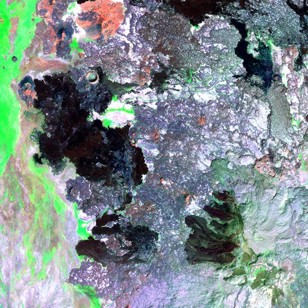
Enhanced Landsat image used for remote mapping.
Following removal of haze effects and data conversion, the FLAASH atmospheric correction algorithm has been applied to provide a measure of ground reflectance for each image pixel. These data have been compared to spectral reflectance curves of known geological materials to provide an interpretation of the geology within the region. Field observation is then focussed on particular areas to verify the accuracy in image interpretation thus allowing vast areas to be mapped rapidly and reducing the time and effort spent on conventional fieldwork.