
Hammond et al, 2010
Interpreting spatial variations in anisotrophy: insights into the Main Ethiopian Rift from SKS waveform modelling, Hammond et al 2010
Non-technical summary
This paper looks at the properties of the crust and upper mantle beneath the Main Ethiopian Rift using mathematical modelling of seismic waves. Seismic waves are waves of energy released by earthquakes. The speed the waves travel through the Earth depends on the direction they travel in and the properties of the rock layers they pass through. This information is recorded by seismometers and can be used to infer the structure of the Earth – for example the seismic waves will travel more slowly through a layer of molten rock than through solid rock.
For the Main Ethiopian Rift, the model that best fits the observations is of a 100-km wide rift zone with a molten rock (melt) present at a depth of about 90km. The melt formed here migrates upwards to feed the rift zone. The data also show more melt lies beneath the western margin than the eastern margin of the rift. This information is added to other observations of the area from different studies to refine the model of the geology of the Main Ethiopian Rift.
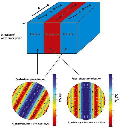
Figure 1: Variations in the direction of propagation of seismic waves across the Main Ethiopian Rift.
Full paper (PDF file)