 There
are several ways that we can demonstrate that the plates are moving today.
There
are several ways that we can demonstrate that the plates are moving today. There
are several ways that we can demonstrate that the plates are moving today.
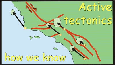
The most obvious manifestation of moving plates are earthquakes. These can occur in volcanoes or (small ones) by artificial explosions. But the vast majority of the world's earthquakes are caused by sudden movement on faults. To see how faults cause earthquakes, click here. By combining the records of many different earthquake detecting instruments (seismometers) it is possible to establish the type of fault and the relative sense of slip by constructing earthquake focal mechanisms. These give powerful views of what is happening on plate boundaries.
Direct measurement of plate motions is difficult. Offset archaeological features can be used to establish time-averaged slip rates on faults. It is possible to use laser ranging surveys across parts of plate boundaries on land (for example the strands of the San Andreas Fault system in California) which can detect the few cm a year movement. However, these land-based surveys are of limited use in detecting movement across entire plate boundaries. Fortunately, particularly through the 1990s and on, a series of space-based surveying methods have been used. These rely on detecting movement averaged out over several years.
One approach is to use the slight differences in arrival time of natural radio signals emitted from quasars detected by different radio-telescopes. This method, called Very Long Baseline Interferometry (VLBI) can be used to determine very precisely (within 2 cm or so) the distance between different radio-telescopes. So making measurements over several years allows changes in the relative position of radio-telescopes (and hence the land upon which they are built) to be charted. These measurements use the stars as their reference frame.
An alternative approach uses reflective satellites in Earth orbit. Satellite Laser Ranging (SLR) relies on short bursts of laser light sent to satellites and reflected back to the laser station. Measuring the travel time (to picoseconds) determines the distance to satellites and therefore repeated measurement for a single state determines its position relative to the constellation of reflective satellites. The same can be done for different ground stations and then the data used in the same way as VLBI. In this case however, the reference frame for detecting active plate motions (time-averaged over a few years) is a series of Earth orbits.
Another approach, which is now receiving great prominence, is to use the satellites of the Global Positioning System (GPS). Fixed GPS receivers collecting positional data from the GPS satellites over several days are accurate to 2 cm or so. These provide a spaced array of points which may be used to detect movement - particularly when calibrated against SLR or VLBI methods. But the great thing about GPS is that cheap, mobile receivers can be used (rather higher spec than those used for navigation by hill-walkers!) and hence big surveys can be carried out. These are revolutionising the way in which we view pate tectonics, particularly as manifest on the continents. As with SLR, the reference frame is extra-terrestrial, provided by the array of Earth orbits occupied by the GPS satellites.
![]()