Simplified map of the Heilam subarea
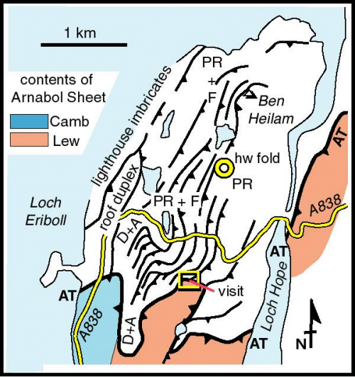
Well-seen from the northern crags of Ben Arnaboll, the ground to the north of the A838 shows abundant evidence of imbrication. Leading down to the River Hope, the eastern slopes of Ben Heilam contain imbricated Pipe Rock, which are exposed as prominent ridges, and Fucoid Beds which form hollows. Skolithos within the Pipe Rock is generally deformed with elliptical bedding-plane sections and inclined profiles relative to bedding. Fischer and Coward (1982) show these strains to be primarily due to folding associated with thrust ramps. Some of these fold structures and the related ramps are spectacularly exposed. The thrusts themselves are locally exposed and are marked by a few cm of fault gouge and ultramylonite (White, 1979).
The Heilam district is noted for the imbricated mid-upper Cambrian strata that crop out along the coast. These are especially well-seen near the lighthouse, particularly from the sea. Despite the narrow width of the imbricates show remarkable lateral persistence, although the imbricate thrusts climb up and down section to incorporate slight stratigraphic variations along strike.