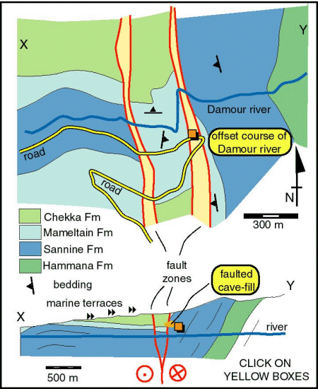
The Roum Fault system at the Damour valley

The Damour valley contains the faulted contact between folded rocks
of the Chouf hills (Jebal Barouk-Mount Lebanon block) and the flat-lying
coastal terrain of the Tyre-Nabatiye plateau. The fault zone is several
hundred metres wide and contains at least two main strands. These show
strike-slip straie. The course of the Damour river is deflected several
hundred metres. However, this offset is not the finite displacement on
the fault - other disrupted drainage is evident here. Although total
displacements
cannot be established, the section is important because at least some of
the faulting may be linked to landscape evolution and thus dated. Critically
the fault zone offsets the Damour gorge and thus post-dates the marine
terraces into which the gorge has incised. Furthermore, the faults deform
cave features that formed once the area was above water table. All this
points to very young displacements on the Roum Fault system - a conclusion
concistent with the seismicity.
