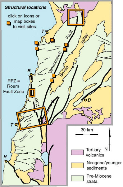
You can use this location map to visit a series of sites around Lebabon. The outline boxes link to more detailed maps of areas, Wadi Chadra (in the north), Beaufort - Nabatiye in the south and the Damour valley just to its north. Information associated with these areas allow you to link tectono-geomorphic landforms with an interpretation of tectonic activity. Consequently you can visit the northern area to find evidence for the Yammouneh Fault (or at least this northernmost segment) being inactive as far a strike-slip displacements are concerned for the past 7 Myr. The implication is that landforms further south (which you can visit by clicking on the small boxes) are ancient and do not imply active slip on the fault. You can compare this situation with that of the Roum Fault Zone (in both detailed areas). In these sites, landforms younger that the late Miocene are offset and cut by the fault zone. You can find information on a variety of scales. You can also find evidence for active uplift that happens together with transcurrent motion, particularly by visiting the coastal sites. Compare your findings with the seismicity.