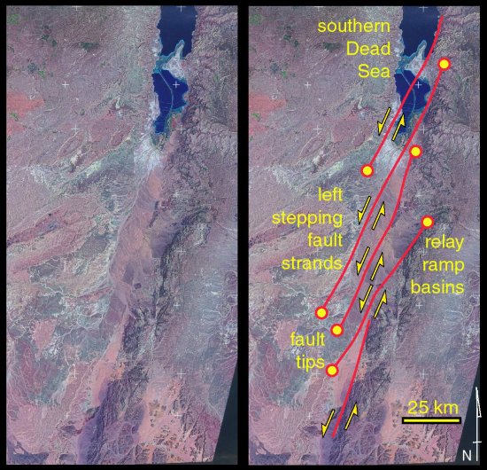
This scene shows the basins developed in the southern part of the transform, along the Israel-Jordan border. The southern edge of the Dead Sea appears at the top of the image. Note that there is no through-going fault here - despite the 100+km of bulk displacement on the transform. Presumably fault strands have transitory existences - growing and slipping, perhaps rotating and then being replaced (and cut by) younger strands. The old fault segments may be represented by the bed rock lineaments on the satellite image - but obviously they are obscured by young sediment in the basins themselves.