In active tectonic regimes the deformation is commonly tracked
using offset landscape features. A major limitation of using this morphotectonic
approach lies in the general problem of dating landscape features. If we don't
know how old a feature is then all we can say is that the fault, uplift or
fold is younger than some unknown age. But in the margins of the Dead Sea
transform system in nothern Israel, Lebanon and Syria, old landscapes are
covered in lavas. Some of these seal faults so we can use radiometric ages
on the lavas to give the youngest age of significant displacements on particular
structures. In other cases we can link lavas via the landscape of valleys
and surfaces to the structural features of interest.
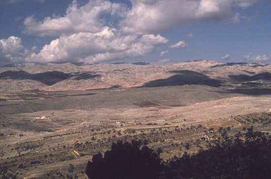
In the view above the Mechki Basalt lies confined in the palaeo-Hasbani
(=headwaters of the Jordan) river valley. The modern drainage incises the
basalt but the valley was there in some form when the basalt erupted. the
basalt also seals the Hasbaya Fault.
TO VISIT THIS AND OTHER SITES - CLICK HERE