STRUCTURAL INTERPRETATATION OVERLAIN ON DEM
RELATIONSHIP BETWEEN GEOMORPHOLOGY AND FAULTS
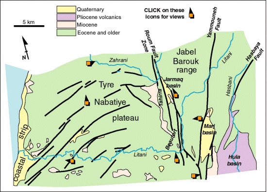
This simplified map of SW Lebanon shows the main fault strands.
You can visit various sites to see how these structures relate to the landscape.
The Tyre-Nabatiye plateau owes its origin to a coastal surface of Miocene age
that has subsequently been uplifted to its present elevation (up to 500m above
sea level). The plateau has been incised by rivers as the uplift continued -
but the sinuosity of the river courses suggests that they originally ran across
the old coastal plain. If you look at the DEM you be able to identify old courses
- now abandoned - in the landscape. These testify to the capture of the upstream
drainage basins - presumably by movement along the Roum fault system.
The Roum Fault system itself is marked now by a series of fault strands. These
strands have modified shutter ridges and basins on their flanks. The pattern
of ridges and basins is consistent with left-stepping relay ramps (on the left-lateral
transform segment) together with weak transpression on each fault strand. These
deductions are consistent in turn with the model for active tectonics illustrated
elsewhere in this site.
| Dead Sea Transform front page | Structural locations map |