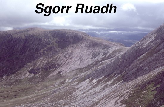
The mountainous country between Glen Torridon (in the north) and Strath Carron (in the south) contains large scale imbricates of Torridonian and Cambrian sediments. In contrast to the imbricate structures in the better-known areas further north, this sector of the thrust belt is characterised by thrust ramps than cut regularly up and across the full stratigraphic succession. Thrust flats are only weakly developed in the quartzites. Consequently the imbricate slices are thick, generating significant amounts of structural thickening with only small amounts of horizontal shortening. This is reflected in the map trace of the Moine Thrust which has been eroded from above this thrust stack. The area is a large-scale structural culmination, comparable to, but much simpler than, that at Assynt. The Sgorr Ruadh imbricate system passes NE to Beinn Eighe before branch together at Loch Maree (see Kinlochewe web pages) and runs SW, climbing section and joining the Kishorn Thrust in its type area (see Kishorn web pages).
The chief virtue of the Sgurr Ruadh area, and the main reason for proposing its inclusion in the Geological conservation Review, is its simplicity. The alternations of Torridonian and Cambrian sediments are recognisable from a distance making the area amongst the best places in the British Isles for demonstrating thrust geometry to non-specialists. The scale of thrust slices is similar to that found in many other foreland thrust belts (in contrast to the finer scale imbrication in the north of the belt). A series of valley sections provide near-ideal profiles, up to 600m high. Individual thrust ramps may traced through the landscape for up to 10 km along strike.
| Moine Thrust Belt front page | Southern areas location map |