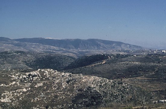
Looking east towards Jabel Barouk (far ridge) from the Tyre-Nabatiye
plateau. We're looking up the Zahrani river gorge - incised into the plateau
surface. The plateau terminates ahead at the Roum Fault Zone. The truncated
spurs on the facing slopes in the distance are on the far side of the fault.
The fault zone separates the foreground plateau morphology from the uplifted
range beyond. This landscape divide was developed at sea -level in
the Miocene - as indicated by coastal fan complexes perched along the eastern
edge of the plateau, sourced from the range beyond (or at least its now-offset
northern continuation).