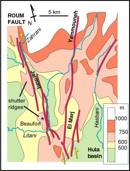
Simplified map showing the arrangement of ridges and basins associated with
the faults in southern Lebanon. The topography image is created by smoothing
- using a median elevation for each square kilometre and recontouring the result.
The shutter ridges on the western side of the fault segments show evidence of
active uplift and shortening (tilted Miocene sediments) rather than simply represent
sliced and offset ridge morphologies.
| Dead Sea Transform front page | Plateau map |