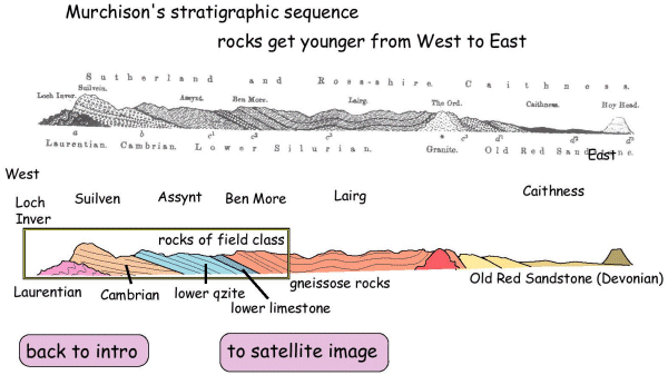
Murchison's hypothesis was illustrated on his interpreted sketch section through northern Scotland. This purports to show rock sequence and geological order through the Assynt area, continuing further east. The rocks are shown, dipping and younging eastwards. On the regional section you should be able to identify unconformities between Murchison's "Laurentian", "Cambrian", "Lower Silurian" and "Old Red Sandstone". Note that these and some of the other names are no longer used for these units but are explicit to Murchison's model. So beware being fixed on names.
TASK: Label the unconformities.