
Ethiopian and Somalian Plateaux (non-technical)
Geology of the Ethiopian and Somalian Plateaux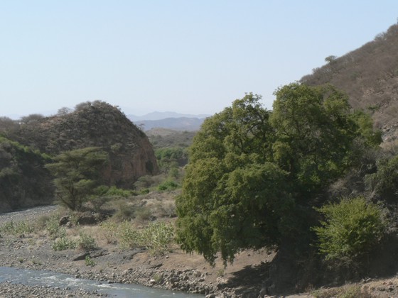
The Ethiopian plateau (aka Ethiopian Highlands) covers much of the north and west of Ethiopia. It is heavily dissected by rivers which have cut down into the landscape as the plateau has been uplifted. The plateau is between 1500m and 4900m high. The escarpment drops from the plateau at about 3000m to the Afar Depression at about 100m elevation in a series of north-south trending faults and fault blocks. The fault blocks dip towards the rift and are heavily eroded. Along the bottom of the escarpment are a series of long, narrow basins which formed during the early stages of faulting along the western margin of the Afar Depression. The escarpment is a transition zone between the thick crust of the Ethiopian plateau and the thin crust of the Afar.
The Somalian Plateau is the continuation of the Ethiopian plateau on the southern side of the Afar rift zone and extends from western Somalia into southeast Ethiopia. The escarpment is similar to its western counterpart with tilted fault blocks. However, instead of a series of basins along the bottom of the escarpment there are isolated volcanic centres.
Top: River heading into Afar from the Ethiopian Highlands. Photo by Tim Wright, University of Leeds, 2006.
For references used, please see technical version.
Structural Geology of the Afar Region
Southern Red Sea and Gulf of Aden