Working Group A
- Home Page
- About the Afar Rift Project
- About the Consortium
- About the Afar Region
- Geology of the Afar Region
- News
- Results and Publications
- Fieldwork Campaigns
- Information for Schools
- Photo Gallery
- Links
- Contact Us
- For Consortium Members
Experimental Programme Working Group A:
Where melt forms and ponds in the crust and mantle and how this correlates with zones of lithospheric stretching
Magnetotellurics (MT): Magnetotellurics uses the electromagnetic fields that occur naturally within the Earth to study the variations of electrical conductivity of the rocks. Areas of high conductivity may represent magma or partial melting of the rocks. Investigating the variations in how the crust and uppermost mantle conduct electricity gives an insight into the structure of the crust, as well as the location of magma generation and storage. Knowledge of the location of the magma allows assessment of potential hazard, particularly along the Hararo segment of the rift, on which the regional capital sits. Magnetotelluric data will be acquired along two profiles using 4WD vehicles, camel and helicopter transport.
Seismic Tomography and Analysis: Seismic waves are generated during earthquakes. We plan to set up network of forty seismometers across the plate boundary zone to record seismic activity. By comparing the arrival times of seismic waves at the seismometers across the network we will be able to determine variations in the seismic velocity of the region (tomography). This information can be used to generate a three-dimensional image of the crust, crust/mantle boundary, mantle structure and base of the lithosphere across the study area.
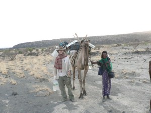
Leeds PhD student James Hammond bringing home the camels laden with seismic and GPS gear. Photo by Tim Wright, University of Leeds.